
Faroe Islands: What It’s Actually Like to Go to the Most Remote Place in Europe
No crowds, no tourist infrastructure, no guarantee of sun — and somehow, one of the most affecting places you’ll ever go. A honest guide to visiting the Faroe Islands for the first time.
The Faroe Islands sit in the middle of nowhere, technically. On a map, they appear as a small scatter of 18 islands in the North Atlantic — closer to Iceland than to mainland Europe, roughly equidistant between Norway and Scotland. Administratively they’re part of the Danish realm, though culturally they operate more like a nation that politely tolerates outside involvement. The population of the entire archipelago is around 55,000 people. That’s a mid-sized town spread across mountain terrain and Atlantic ocean.
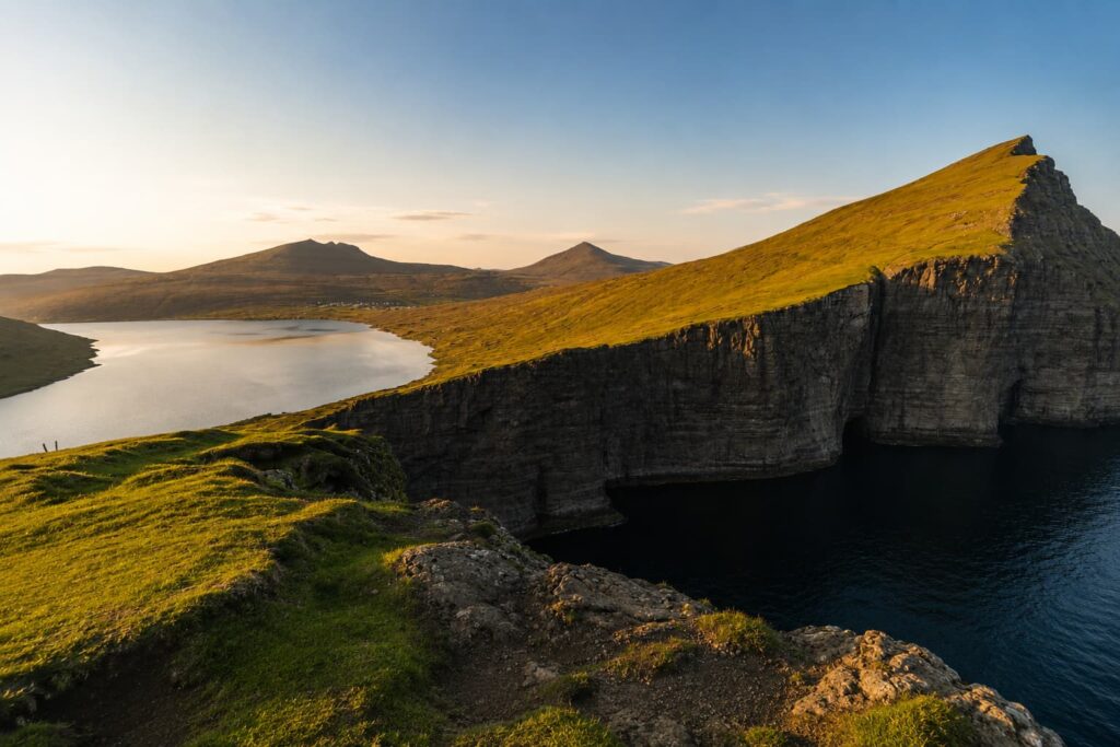
Vertical Cliffs of Faroes
Most people know the Faroes from photographs: vertical cliffs, grass-roofed houses, a lake that appears to pour directly into the sea. What the photographs don’t convey is the physical sensation of being there — the weight of the wind, the speed at which weather moves across the landscape, the way a cloudy afternoon turns luminous without warning. The Faroes are not a destination that performs for you. They exist on their own terms entirely, and the experience depends largely on how much you’re willing to meet them there.
Furthermore, the Faroes require a certain kind of traveler — someone comfortable with unpredictability, who doesn’t need every meal to be well-reviewed, and who can find beauty in grey. If that sounds like you, keep reading.
01 — What to Actually Expect When You Arrive
The weather is not a rumour
Everything you’ve heard about Faroese weather is accurate, and then some. The islands experience around 300 days of rain per year. Fog, however, is arguably the defining atmospheric condition — thick, fast-moving, and completely indifferent to your plans. A summit that was visible an hour ago disappears entirely. A trail you started in sunshine requires a headlamp by the time you return. Additionally, wind — real wind, not a coastal breeze — shapes what’s possible on any given day. Gusts regularly exceed 80 km/h in exposed areas.
None of this should discourage you. In fact, the weather is part of why the Faroes feel so different from anywhere else in Europe. The light that breaks through after a storm, the way the sea changes colour depending on cloud cover, the mist rolling over the ridge — these aren’t inconveniences. They’re the point. That said, you should bring gear that takes all of it seriously: waterproof trousers, not just a jacket. Layers you can add or remove fast. Grip on your shoes.
The landscape adjusts your sense of scale
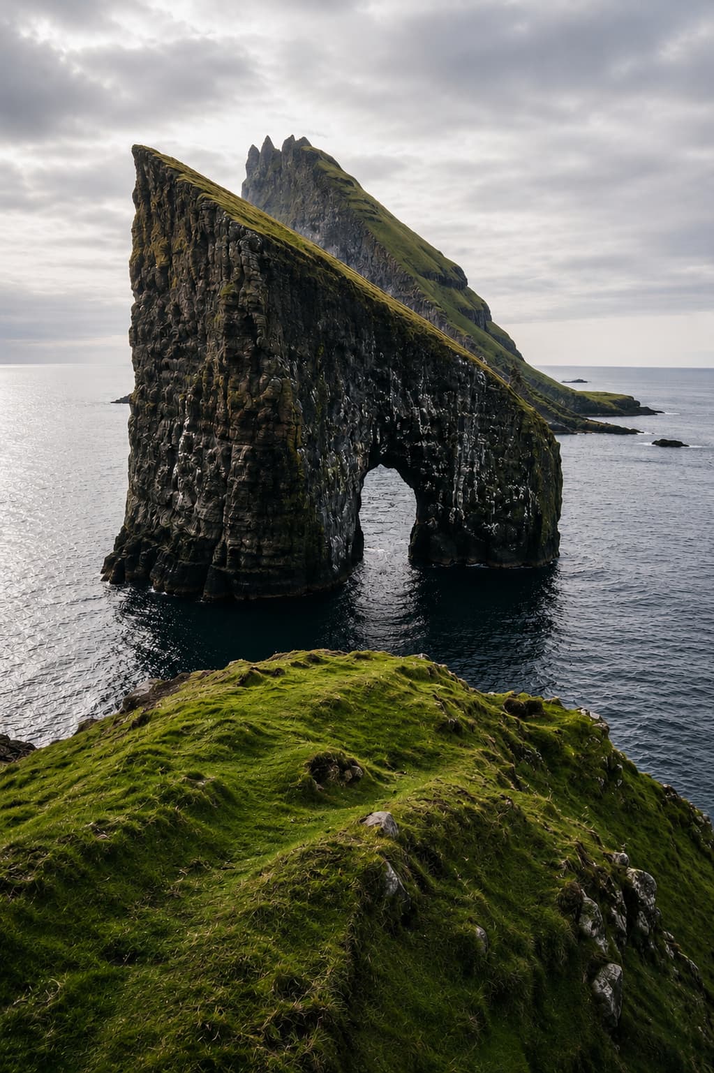
The islands are physically small — the whole archipelago is roughly the size of a mid-size county — but the vertical scale is something else. Cliffs drop 400 metres straight into the Atlantic. Mountains rise from sea level to over 880 metres within a few kilometres. Consequently, everything feels larger than the numbers suggest. You’re not just driving across an island; you’re navigating a place that layers sea, cliff, village, plateau, and sky into a dense vertical sequence.
There are no trees. This is the detail that surprises most visitors. The landscape is entirely open — grass, rock, water, sky. Nowhere to hide from the view, and nowhere for the view to hide from you.
The remoteness is real, not a brand
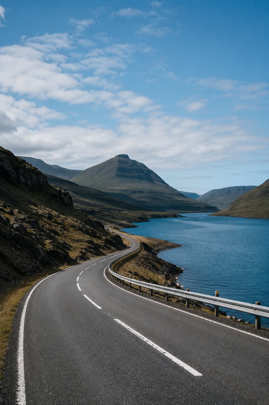
A lot of destinations are marketed as “remote” when they’re really just less popular than Paris. The Faroes are actually remote. Mobile data drops out. Some villages have no restaurant, no shop, no accommodation. Petrol stations are sparse outside the main corridor. Moreover, the islands operate on their own schedule — not everything is open every day, and asking a local when something opens will often produce an answer that depends on factors you can’t see.
This is worth knowing before you arrive, because it changes how you plan. You don’t come to the Faroes with a tight itinerary. You come with a loose framework and reasonable flexibility. The reward for that flexibility is proportional to the effort.
02 — Getting There and Getting Around
Flights
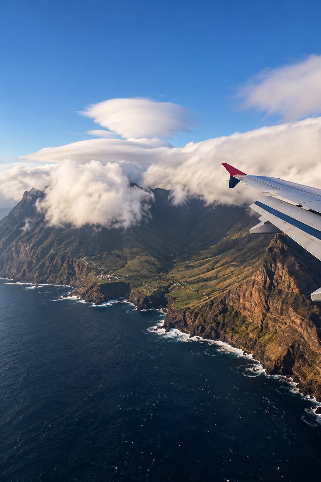
The only international airport is Vágar Airport (FAE) on the island of Vágar. Atlantic Airways, the national carrier, operates direct routes from Copenhagen, Reykjavik, Edinburgh, London Gatwick, and a handful of other European cities seasonally. From most major European hubs, you’ll route through Copenhagen. The flight from Copenhagen takes around 2 hours. Notably, the airport’s approach over the ocean is itself memorable — the runway appears to end at a cliff edge, with sea visible on three sides on final descent.
Fares are reasonable when booked ahead, particularly on Atlantic Airways. The airline has a good punctuality record given the weather-dependent operating environment, though diversions to Iceland do occasionally happen in severe conditions.
Getting around by car
A rental car is essential. Public buses exist, but they’re designed for residents commuting between villages — not for visitors trying to reach viewpoints and trailheads on a schedule. Renting a car, however, unlocks the entire archipelago. The road network is well-maintained, and the undersea tunnels that connect many of the islands are genuinely impressive — particularly the roundabout inside the Eysturoy tunnel, which sits underwater and is, to the best of this writer’s knowledge, the world’s only subterranean roundabout.
Several of the inter-island tunnels charge a toll. The Vágar–Streymoy tunnel and the Eysturoy subsea tunnel both apply fees. Pay online in advance via the Fareyjar portal — the in-tunnel payment process is less straightforward, and some rental agreements require pre-registration. Budget around DKK 75–200 per tunnel crossing depending on your vehicle.
Driving in the Faroes is slow by mainland European standards — the roads are narrow, the mountain passes require careful navigation, and sheep have right of way in practice if not technically in law. That said, there’s almost no traffic. On a weekday morning drive across Eysturoy, you may not pass another car for 20 minutes. The roads are as much part of the experience as the destinations at the end of them.
03 — The Places Worth Going
The Landmark Landscapes
The most photographed spot in the Faroes, and it earns it. The lake sits at an altitude that creates an extraordinary optical illusion — from certain angles it appears to hang above the ocean rather than beside it. The hike to the viewpoint takes around 45 minutes from the trailhead near Miðvágur. Go early. By mid-morning in summer there are queues. The approach is entirely unguarded at the cliff edge, which is either thrilling or terrifying depending on your disposition.
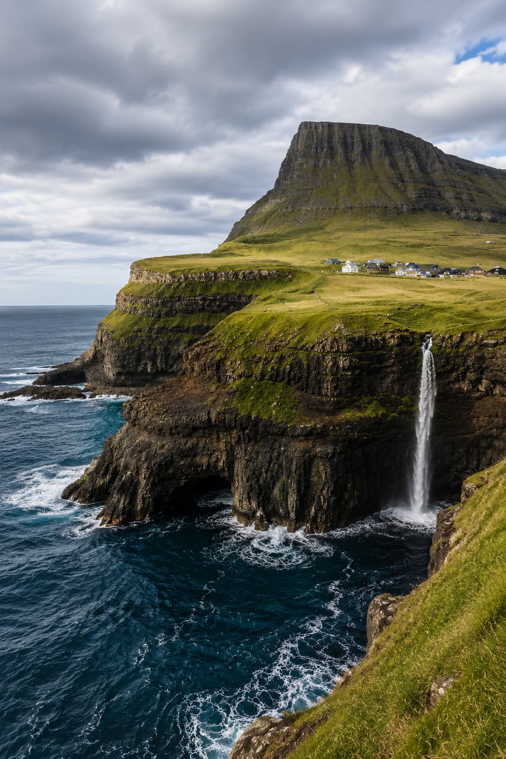
A village of fewer than 20 residents, accessible by a tunnel that was only completed in 2004. Before that, the only way in was a mountain pass requiring a four-hour return hike. The waterfall at Múlafossur drops from the cliff directly into the sea below the village — one of the genuinely iconic images of the North Atlantic. It’s worth spending an hour walking the area rather than just photographing from the road.
A small village on the northern tip of Eysturoy, built around a narrow gorge that cuts through the cliff to the sea — gjógv means gorge in Faroese. The setting is theatrical: coloured wooden houses clustered around a natural harbour no wider than a room. The village has a guesthouse (Gjáargarður) that books up fast but is worth the effort. Additionally, the hiking from Gjógv towards Slættaratindur, the highest peak in the Faroes, starts just above the village.
The Sea Cliffs and Wild Edges
The best way to see the western sea cliffs is by boat from Vestmanna. The tours run through narrow sea caves and past cliff faces crowded with guillemots, puffins, and razorbills. The boats are small — eight to twelve passengers — and get close enough to the rock that spray comes aboard. In rough conditions the inner caves are inaccessible, which is itself worth factoring into your plans. Book ahead in July and August; the tours fill.
At 754 metres, Enniberg is among the highest sea cliffs in the world. Reaching the viewpoint requires a drive to the northern island of Viðoy and a short walk — it’s less visited than the western islands, and consequently quieter. The cliff drops sheer to the ocean with nothing between you and the horizon. On a clear day, the visibility extends far enough to feel genuinely oceanic, not coastal.
04 — Tórshavn: The Smallest Capital in Europe
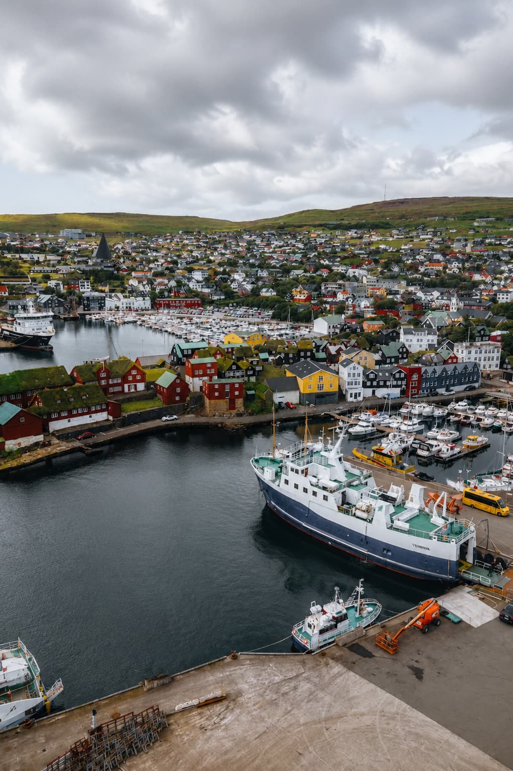
With a population of around 22,000, Tórshavn is the capital of the Faroe Islands and, by most measures, the smallest national capital in Europe. It is not a city in any architectural or commercial sense — more a large town that happens to carry a nation’s administrative weight. The old town, Tinganes, occupies a small peninsula jutting into the harbour. The buildings are wooden, painted in dark reds and blacks, with the ubiquitous turf roofs that define Faroese aesthetics. Narrow lanes, no cars, the smell of the harbour. It takes about 40 minutes to walk the whole of it.
Eating and drinking in Tórshavn
The food scene in Tórshavn is better than the archipelago’s size would suggest. Ræst — fermented lamb, the traditional Faroese preservation method — appears on most serious menus and is worth trying without preconception. It tastes like a more complex version of cured meat, with a depth of flavour that takes a moment to calibrate. Restaurant Koks was, for years, the flagship fine dining destination and held a Michelin star; it has since relocated to Greenland for seasonal service, but its influence on the local food culture persists in several mid-range restaurants that cook seriously with local ingredients.
For everyday eating, the covered market at the harbour has fresh fish most mornings. The bakeries open early. Coffee culture exists and is perfectly decent. Overall, budget around €25–40 for dinner at a mid-range restaurant; the premium options run €80+ per person for a tasting menu.
What to do in the city
Beyond Tinganes, the National Museum (Fornminnissavnið) is a compact but thoughtful survey of Faroese history — the Viking-era artefacts are particularly well-presented. The Nordic House (Norðurlandahúsið) hosts cultural events and has a good bookshop. Moreover, the harbour front is worth a slow hour on any afternoon — the combination of working fishing boats, ferries, and modern architecture against the old town backdrop is quietly distinctive.
05 — Practical Guide to Visiting the Faroe Islands
When to go
June through August offers the longest days — at midsummer, it barely gets dark, which extends hiking windows significantly. July is the busiest month, though “busy” in the Faroe Islands context means you might encounter another group on a trail, not that you’ll be queuing at viewpoints. May and September offer shoulder-season quiet and are excellent for photography — the light is lower, the crowds minimal, and the landscape transitions (late snow on peaks in May; autumn colour in September) add visual interest.
In contrast, November through March is genuinely challenging for visitors. Storms can ground flights, close tunnels, and make driving actively dangerous. That said, some travellers specifically seek the winter experience for the possibility of northern lights, and the islands do deliver. Going in winter requires resilience and genuine flexibility with your travel dates.
Where to stay
Options outside Tórshavn are limited. The guesthouses and farm stays scattered across the islands vary wildly in quality and availability — book far in advance, particularly for the well-regarded spots like Gjáargarður in Gjógv or the guesthouses around Sørvágsvatn. In Tórshavn, the Hotel Hafnia and Hotel Tórshavn are the main mid-range options. For the most immersive experience, renting a self-catering cottage for a week is both cheaper and more atmospheric than hotel accommodation.
The Faroes have piloted a sustainable tourism initiative called “Closed for Maintenance, Open for Voluntourism” — a programme where tourists help with trail maintenance and environmental work in exchange for access. Registrations happen annually in spring. It’s worth checking the Visit Faroe Islands website when planning your trip — the programme has expanded in recent years and participation is a genuinely different way to engage with the place.
| Currency | Danish Krone (DKK). Cards accepted almost everywhere, but carry some cash for small villages and toll roads. |
| Language | Faroese is the primary language; Danish is widely understood. English is spoken by virtually everyone under 60 in tourist areas. |
| Getting there | Fly into Vágar Airport (FAE). Atlantic Airways and SAS from Copenhagen. Seasonal routes from Edinburgh, London, Reykjavik. |
| Car hire | Book ahead — the fleet on the islands is small. International licences accepted. Automatic and manual both available. |
| Hiking safety | Register your route with safetravel.fo before serious hikes. Conditions change without warning. Download maps offline. |
| Budget per day | Budget traveller: €80–100. Mid-range: €120–160. Higher with self-catering cottage + car shared between two people. |
Hiking: what you need to know
The Faroes have an extensive trail network, and hiking is genuinely the best way to see the landscape beyond what’s accessible by road. However, a few things are worth understanding before you lace up.
- Many trails are unmarked or marked only with cairns. Offline maps (Maps.me or Gaia GPS with downloaded tiles) are essential.
- Weather changes faster than almost anywhere in Europe. A clear morning can become zero-visibility fog within an hour.
- Some cliff edges are completely unfenced and easily approached without realising. Keep a cautious distance — the grass near the edge is often wet and the drop is absolute.
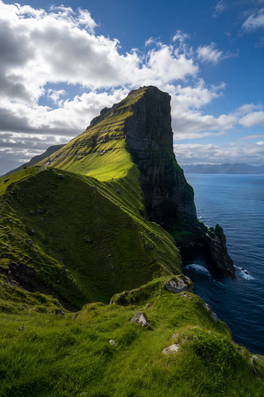
- The trail to Kallur Lighthouse on Kalsoy is one of the most rewarding day hikes — 7 km return, lighthouse at the tip of a narrow peninsula, views of the surrounding islands.
- Some areas require hiking on private farmland. Ask locally; Faroese farmers are generally accommodating, but permission matters.
Solo travel in the Faroes
The Faroe Islands are extremely safe for solo travel. Crime is essentially non-existent, the community is tight-knit without being unwelcoming, and the physical risks — weather, cliffs, open water — are straightforward to manage with preparation. That said, solo hiking requires more caution than hiking with a group. Register your routes, tell someone your plan, and don’t push past your comfort level on exposed terrain. The landscape doesn’t forgive overconfidence, but it rewards careful engagement generously.
Planning Your Visit
Practicalities and Logistics
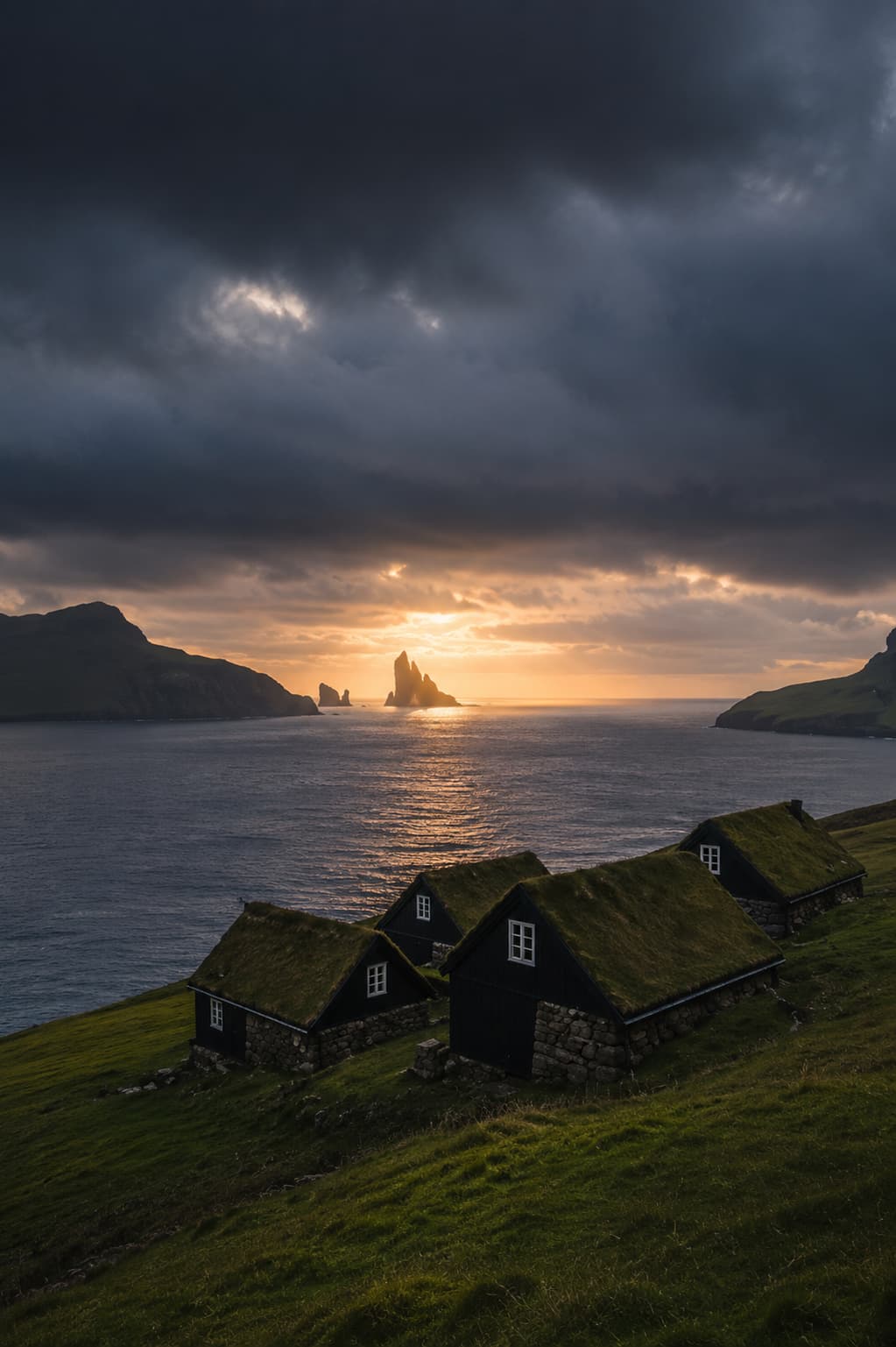
The Faroes will not meet you halfway. They offer something real in exchange for a little effort — and the exchange, on balance, is more than fair.