
Norway Road Trip: Fjords, Scenic Routes & What It Actually Costs
A self-drive guide to Western Norway’s three signature drives — Geiranger, Trollstigen, and the Atlantic Ocean Road — with honest logistics for 10 days on the road.
Why This Norway Road Trip Needs Slow Planning
A Norway road trip does not behave like other road trips. The distances look manageable on a map until you factor in the ferry crossings, the mountain pass closures, and the fact that a fjord you planned to loop around quickly turns out to have no road on the other side. In short, the country is designed for slow movement, and the people who fight that — who try to race through the Western fjords in five days with every stop pre-booked by 7pm — tend to be the ones who arrive back home exhausted and vaguely disappointed.
This guide covers a 10-day self-drive circuit of Western Norway: Bergen as the starting point, the Hardangerfjord as the quieter opener, Geiranger and the Eagle Road as the visual centrepiece, Trollstigen as the route that earns its reputation, and the Atlantic Ocean Road as the finish that surprises most people for entirely different reasons than they expected. Additionally, it covers what the Norwegian Scenic Routes actually are, when to go and what that means for road conditions in practice, and what the whole thing realistically costs — including the figures that catch first-timers off guard.
Quick Route Snapshot Before You Plan
- Why This Norway Road Trip Needs Slow Planning
- How Long Do You Actually Need?
- The Best Route for a Norway Road Trip
- What Are the Norwegian Scenic Routes?
- When to Go — Road Conditions & Timing
- How Expensive Is a Norway Road Trip?
- Is It Difficult to Drive in Norway?
- How This Route Connects to the Rest of Norway
- FAQ
- Honest Verdict
01 — How Long Do You Actually Need?
Most people underestimate Norway. The distances look short, the roads look passable, and the map looks like something that can be done in a week. In practice, a Western Norway road trip built around the three signature drives — Geiranger, Trollstigen, the Atlantic Ocean Road — needs 10 days to be done without making every evening a frantic push to reach the next pre-booked hotel.
Why 10 days is the honest minimum for a Norway road trip
The Bergen-to-Åndalsnes route covers roughly 1,000–1,200 kilometres depending on which ferries you take and which detours you allow yourself. On paper, that sounds like a week of easy driving. In practice, the roads are slower than a GPS predicts — mountain passes have speed limits of 50–60 km/h, fjord roads narrow suddenly, and ferry crossings add 30–90 minutes to most legs that look like straight shots on a map. Furthermore, several of the best experiences on this circuit (the viewpoint above Geiranger, the Trollstigen descent, the platform at Atlanterhavsvegen) reward spending actual time rather than stopping for a photograph and moving on.
Ten days gives you two nights at Bergen, one night in the Hardangerfjord area, two nights at Geiranger or nearby, one night at Åndalsnes, two nights at or near the Atlantic Ocean Road, and one night in Ålesund — with a buffer day built into one of the longer legs. That buffer matters. On a Norway road trip, weather delays, unexpected road closures, and ferry queues are not inconveniences: they are features of the trip.
What gets cut when people try to rush the trip
In a seven-day version, the Hardangerfjord disappears first — it becomes a pass-through rather than an overnight. The buffer days go next. Consequently, any delay (a Trollstigen closure for heavy rain, a ferry that leaves 90 minutes later than planned) cascades across the rest of the itinerary. The Atlantic Ocean Road often gets abbreviated to a single direction rather than the full circuit. As a result, you see all of the major stops but experience none of them properly — which is a particular shame in a country where the drive between the stops is often the point.
Where to add days if you have more time
With 12–14 days, the most obvious additions are a full day on the Hardangerfjord (the area around Eidfjord and the Vøringsfossen waterfall rewards slow time), a second night in Ålesund, and either a Romsdalen valley extension from Åndalsnes or a third night around the Atlanterhavsvegen to properly walk the bridge sections and explore the coastal islands. Beyond that, Sunnmøre and the Hjørundfjord area south of Ålesund add real depth for anyone who wants to avoid the most visited parts of the circuit.
02 — The Best Route for a Norway Road Trip
This circuit runs Bergen–Hardangerfjord–Geiranger–Trollstigen–Åndalsnes–Atlantic Ocean Road–Ålesund. It can be done in either direction, though Bergen-first makes more sense for most international arrivals (Bergen has the better airport connections and is a more forgiving place to arrive jet-lagged than Åndalsnes). Moreover, it builds cinematically: the Hardangerfjord is beautiful and manageable, Geiranger escalates the drama, Trollstigen is the peak, and the Atlantic Ocean Road is an entirely different kind of road that lands differently once you’ve already driven a mountain pass.
The 10-day Norway road trip — day by day
Two nights in Bergen to acclimatise, collect the rental car, and stock up before the roads get more demanding. The fish market, Bryggen wharf, and the funicular to Fløyen viewpoint are all within walking distance of the centre. Don’t rush this part — arriving rested makes the first mountain road significantly less stressful.
City Base
Drive east along the southern shore through apple orchards, stopping at Låtefossen waterfall before overnighting at Eidfjord. The road here is wide and unhurried — a good place to calibrate your sense of Norwegian driving before things narrow considerably later on.
Scenic Drive
Two nights near Geirangerfjord — the UNESCO-listed fjord ringed by the Seven Sisters and Bridal Veil waterfalls. Drive the Eagle Road (Ørnevegen) at dawn or dusk when the coach traffic drops. The viewpoint at the top looks back the full length of the fjord and changes completely with the light.
UNESCO Fjord
Days 6–10: Trollstigen, Atlantic Ocean Road and Ålesund
Check vegvesen.no before leaving — Trollstigen closes for heavy rain even in summer. Drive from Valldal, descend the eleven hairpin bends with the Stigfossen waterfall audible alongside, and overnight in Åndalsnes at the valley floor.
Mountain Pass
Drive northwest to the Atlanterhavsvegen — 8.3 km of road across open sea skerries connecting Vevang and Kårvåg. Two nights here allows you to drive it in both directions and at different weather conditions, which is the whole point. Overcast with a westerly swell beats a blue-sky day entirely.
Coastal Road
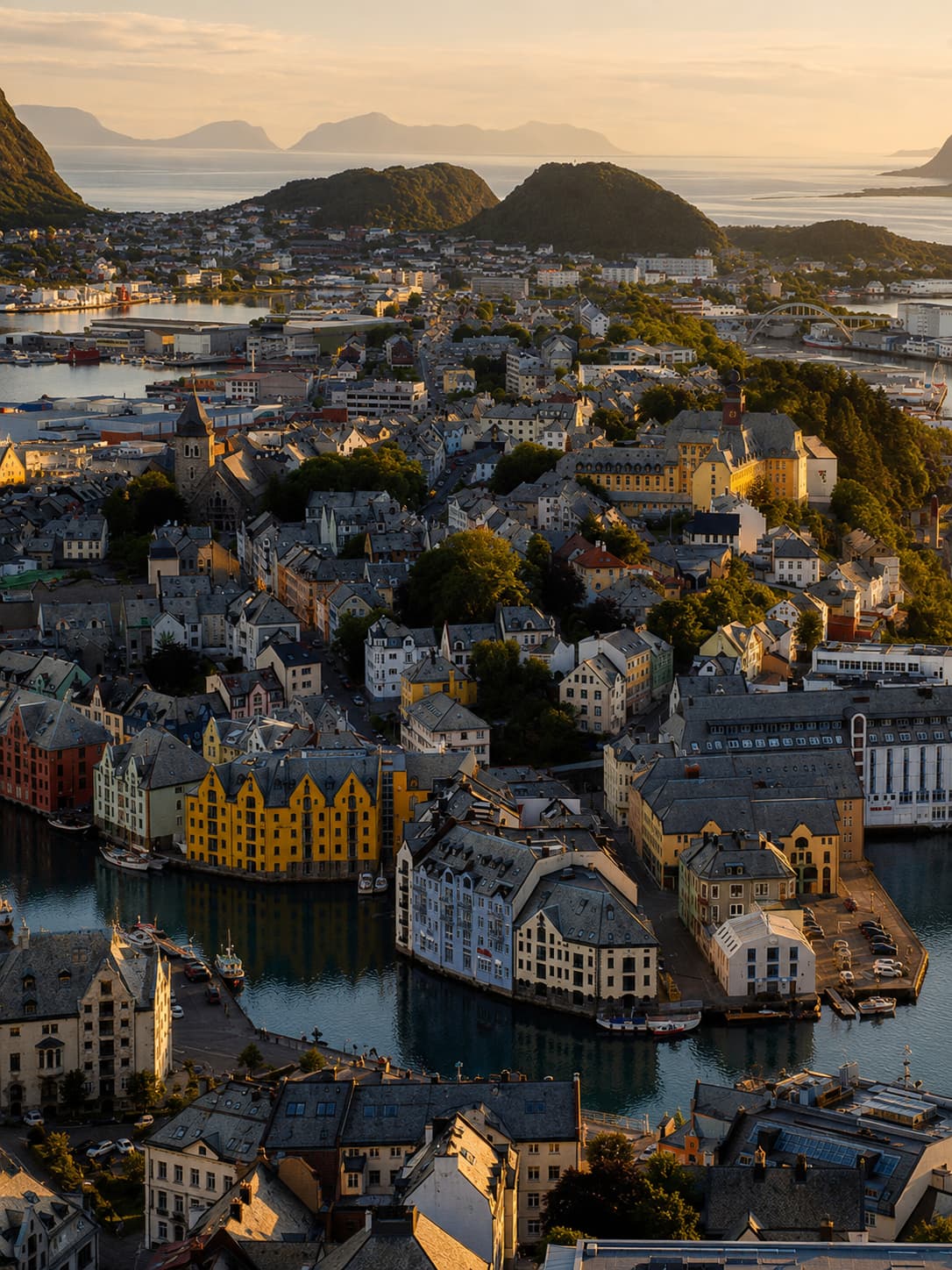
Drive south to Ålesund — rebuilt entirely in Art Nouveau style after a fire in 1904, with almost every street ending in water. The viewpoint at Aksla gives a panoramic orientation that puts the islands in proper context. Most Norway road trip itineraries treat it as a waypoint; in contrast, it deserves a proper evening.
City Stop
Finish in Åndalsnes for a train connection to Oslo, or loop back to Bergen via E39 south (roughly 300 km of faster main roads). Åndalsnes is the cleaner finish unless you need to return the car to Bergen specifically.
End Point
Bergen as the starting point — and why it works
Bergen earns its place as the gateway not just through airport logistics but through character. It’s a working port city with a fish market, a funicular to a viewpoint, and enough restaurants and neighbourhoods to spend two days without running out of things. More practically, Bergen is where you pick up the rental car, stock up on provisions, and adjust to the rhythm of Norwegian driving before the roads get more demanding. Furthermore, the city sits at the western edge of the fjords in a way that means Day 1 of the circuit is already scenic, even before you reach anything on a list.
Geiranger and the Eagle Road
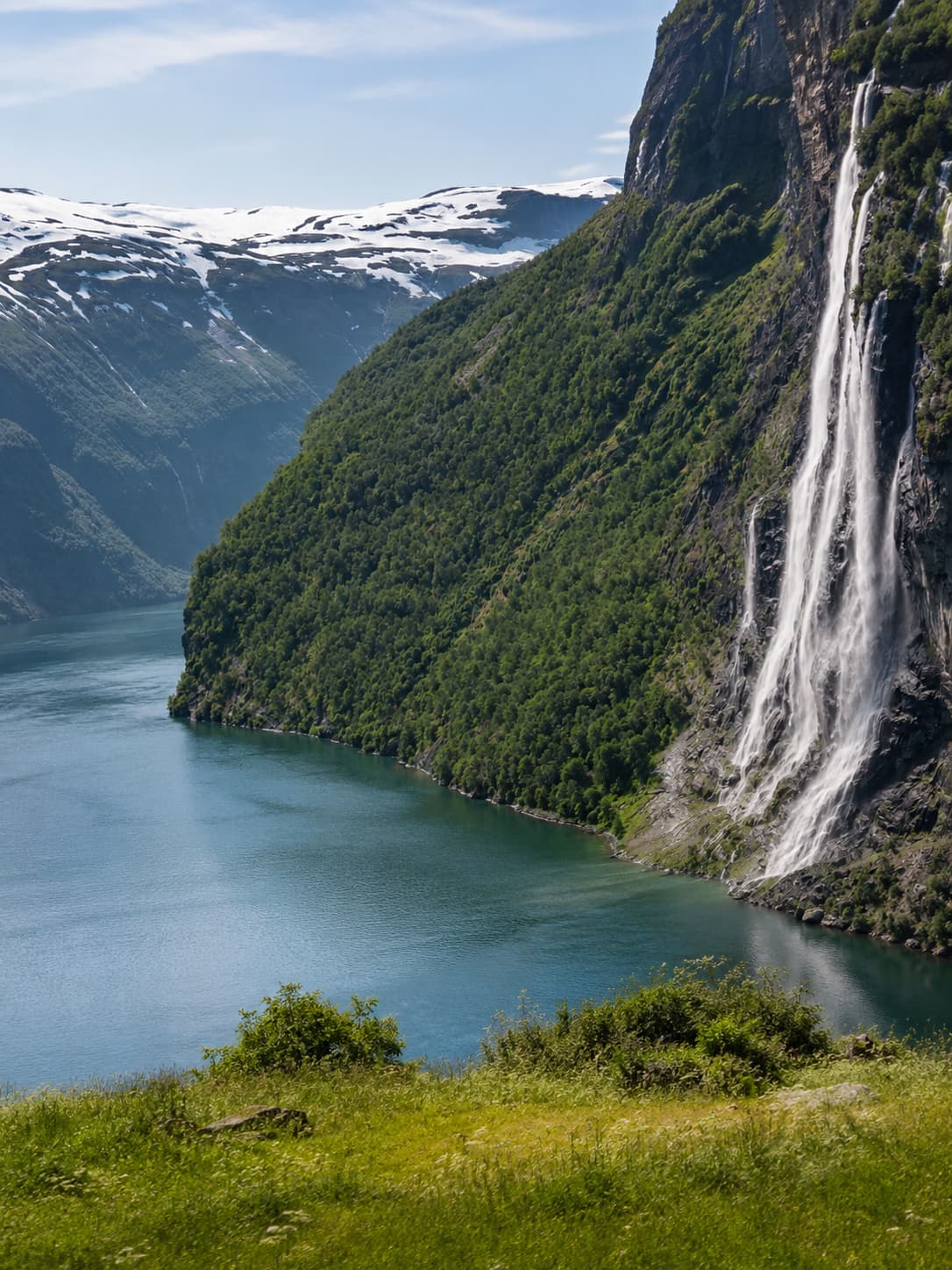
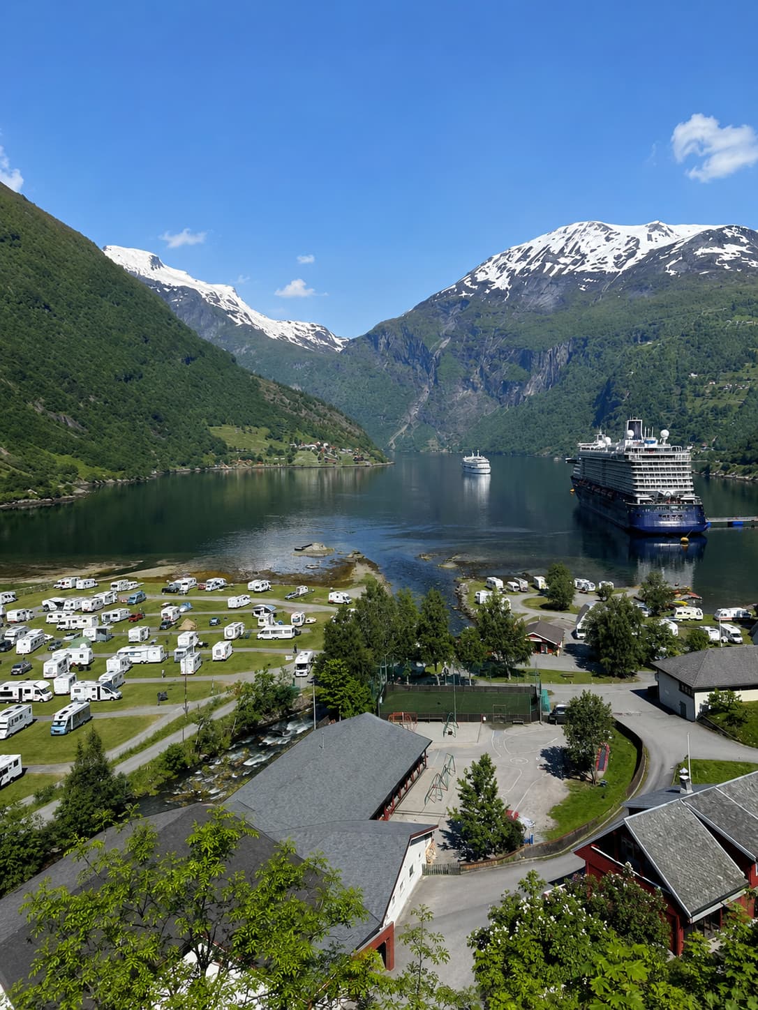
Geirangerfjord is Norway’s most photographed fjord and a UNESCO World Heritage site, and neither fact is wrong — the fjord is genuinely extraordinary, the waterfalls (Seven Sisters, Bridal Veil, Suitor) visible from a boat in the summer season are among the most dramatic things on the entire circuit. However, Geiranger village itself is small and overwhelmed by cruise tourists in July, which is one of several reasons that June or September visits work better on this route.
The Eagle Road (Ørnevegen) climbs from Geiranger on 11 hairpin bends with a viewpoint at the top that looks back down the full length of the fjord. Most visitors stop here for fifteen minutes. However, staying longer after the coach parties have moved on is worth it — the light on the fjord changes considerably between midday and late afternoon, and the full length of the Seven Sisters waterfall only becomes visible from certain positions on the road below.
Trollstigen — the road that earns its name
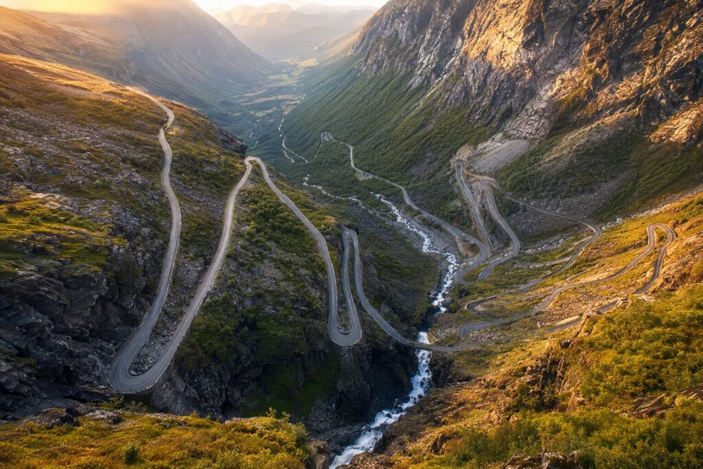
Trollstigen (literally “the Troll’s Path”) is Norway’s most famous mountain road and genuinely deserves its reputation, though not quite for the reasons its photographs suggest. The eleven hairpin bends look terrifying from above; from behind the wheel, however, they are less dramatic than expected, because the road is wider than it appears in images, the barriers are solid, and the traffic (at least outside peak July) moves in a reasonably orderly way. In particular, what photographs don’t convey is the sound — the Stigfossen waterfall runs directly alongside the road for the entire descent, and the combined noise of the falls and the mountain air is the thing that actually stays with you.
Trollstigen is typically open from late April to October or November, with exact dates depending on weather conditions each year. In 2026, the road opened on April 27 — a record early opening following rockfall protection work carried out in 2024–2025. However, in future years the typical window runs from mid-May through October. Always check current status on vegvesen.no before driving this section, particularly in spring and late autumn when closures for rain or snow happen without much notice.
Trollstigen closes temporarily when heavy rain increases rockfall risk, even in summer. Check live road status at vegvesen.no the morning you plan to drive it. A closure here shifts the Åndalsnes leg — build 24 hours of flexibility into this part of the circuit so a one-day closure doesn’t rearrange the rest of the trip.
The Atlantic Ocean Road — what the Norway road trip photos don’t show
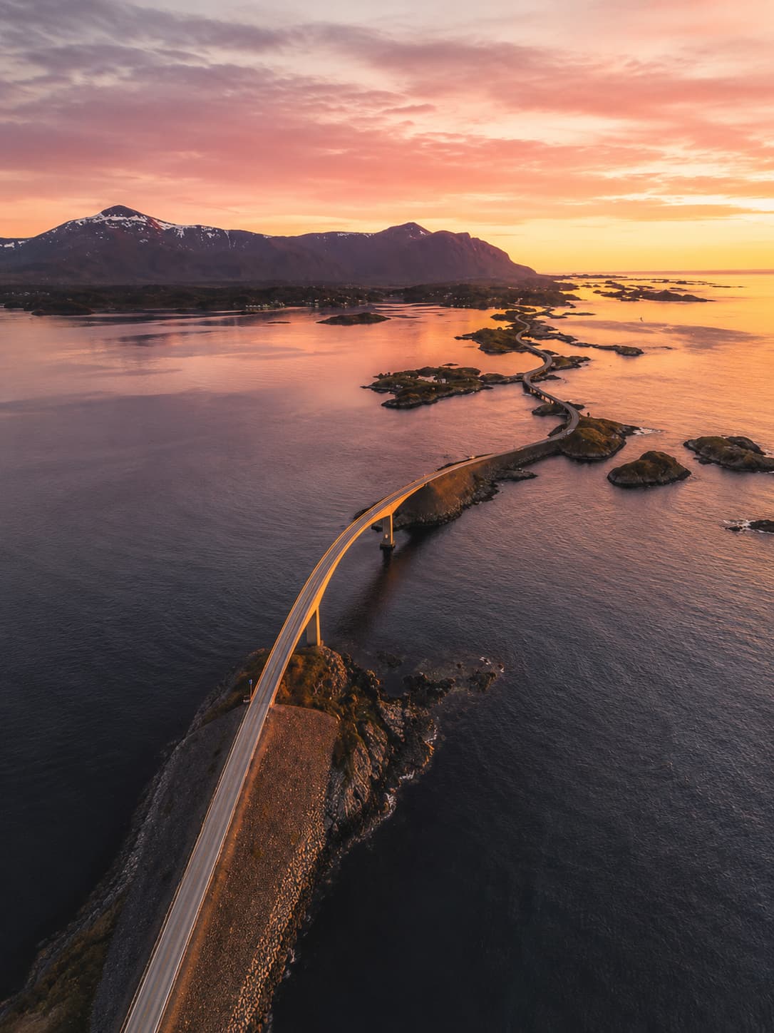
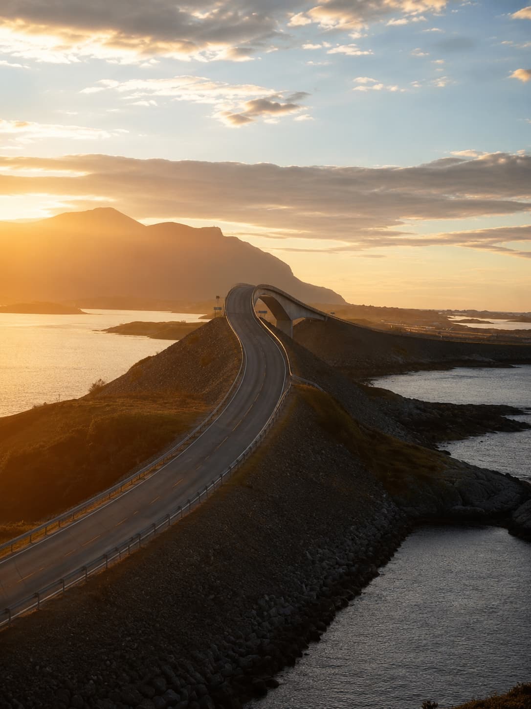
The Atlanterhavsvegen is an 8.3-kilometre coastal road across a series of small islands and skerries on the Møre og Romsdal coastline, connecting Vevang and Kårvåg. It is one of Norway’s most photographed landmarks and one of its most unusual driving experiences — not dramatic in the fjord sense, but quietly strange, with the road dropping and rising across the open sea in a way that feels engineered for a different purpose than getting from A to B.
What photographs routinely underplay is the weather. The Atlanterhavsvegen sits on an exposed stretch of the Norwegian coast, and the wind and sea spray in a westerly blow are part of the experience rather than an inconvenience to avoid. In genuinely bad weather it can feel like the road is disappearing into the Atlantic. On the other hand, in calm weather it can feel anticlimactic. The interesting version sits in between — overcast, with movement in the water and a grey Atlantic light that makes the whole thing feel like the edge of something.
03 — What Are the Norwegian Scenic Routes?
Norway operates 18 designated National Scenic Routes (Nasjonale Turistveger) — a government programme that identifies specific stretches of road for their landscape and driving quality, then invests in architect-designed viewpoints, rest areas, and facilities along each one. In total, they cover approximately 2,240 kilometres across the country.
Which scenic routes overlap with this Norway road trip
Three National Scenic Routes run directly through the Western Norway circuit described here. The Geiranger–Trollstigen route is arguably the most famous in the entire network, connecting the two most dramatic sections of the circuit on a single classified stretch. Additionally, Gamle Strynefjellsvegen (an old mountain road east of Geiranger, unpaved in sections) and Atlanterhavsvegen are both designated routes — the latter being particularly celebrated for its engineering.
The flagship of the Norwegian Scenic Routes network, running from Geiranger through the Eagle Road, over the Valldal valley, and down Trollstigen to Åndalsnes. Viewpoints designed by Norwegian architects sit at several intervals — the most celebrated is the Trollstigen National Tourist Route Visitor Centre, which cantilevers over the cliff above the falls.
The Atlantic Ocean Road has its own Scenic Route designation and several stop-off viewpoints, including the Eldhusøya rest area which extends into the sea on a wooden platform. Since its initial designation, the road’s infrastructure has been upgraded repeatedly, and the architect-designed facilities are, unusually, actually worth stopping at.
Runs along the southern shore of the Hardangerfjord through Ulvik, Eidfjord, and Odda. The viewpoints here are more modest than Geiranger’s, but the road passes through Låtefossen — a double waterfall that runs directly alongside the carriageway — and the apple orchards around Ulvik in blossom season (typically May) are a legitimate reason to time the circuit for late spring.
What the architect-designed viewpoints are actually like
The viewpoints on the Norwegian Scenic Routes range from genuinely impressive (the Trollstigen visitor centre, the Aurlandsfjellet “Snowroad” lookout at Stegastein) to modest in reality despite the architectural effort. In general, the further a viewpoint sits from the most-visited sections of the route, the more rewarding it tends to be — partly because the views are equivalent, partly because you’re less likely to be surrounded by a tour bus’s worth of people trying to photograph the same railing. On balance, the programme is a genuine contribution to the experience of driving in Norway. That said, it doesn’t require treating every marked viewpoint as a mandatory stop.
04 — When to Go on a Norway Road Trip
The conventional advice for Norway in summer is to go in July. This is accurate if your priority is guaranteed road access, maximum daylight, and settled weather. It is less accurate if your priorities also include affordable accommodation, manageable crowds at the major viewpoints, and not spending July mornings trying to find a hotel that doesn’t cost twice what it would in June.
Why June and September beat July for this route
June on this circuit gives you nearly everything July offers — long daylight hours, all mountain passes open, full ferry schedules — with materially less competition at the viewpoints and meaningfully lower prices. The midnight sun is fully operational by late June. As a result, the Trollstigen viewpoint at 8am in mid-June is a different experience from the same viewpoint at 11am in late July. In September, the crowds drop sharply after the school holiday period ends. The light changes — lower, warmer, more directional — and the mountain colours begin shifting. Trollstigen typically stays open until October or November, so September access is reliable. Additionally, September accommodation prices fall noticeably from their July peaks.
July specifically is the most expensive and most crowded window. Geiranger fills with cruise passengers from mid-morning. Moreover, accommodation at Åndalsnes and near the Atlantic Ocean Road books out weeks in advance at peak rates. If July is the only window available, go — the experience remains worthwhile — but book everything at least six to eight weeks out and build more buffer into the itinerary than you think you need.
Trollstigen’s seasonal closure — how to check it
Trollstigen closes every winter and typically reopens somewhere between mid-May and early June, depending on when the snow clears from the upper section. In 2026, it opened on April 27 — the earliest opening in recorded history, following extensive rockfall protection work carried out in the previous two seasons. However, this early date is not a new baseline; it reflects specific 2026 conditions, and future opening dates will continue to vary annually.
Furthermore, Trollstigen can close temporarily during summer for heavy rain events that increase rockfall risk. These closures are usually 12–48 hours. Therefore, check the live road status at vegvesen.no or the Statens Vegvesen app the morning you plan to drive the pass — not the night before, and not based on the conditions at Åndalsnes, which can be dry while the pass itself is closed. Building one day of scheduling flexibility at this part of the route is the practical way to handle it.
The coolcation angle: why Western Norway in summer works
Searches for Norway on major booking platforms were up significantly year-on-year in summer 2026, part of a broader northern Europe coolcation trend that’s been building for several years — driven partly by increasingly uncomfortable Mediterranean summers and partly by a genuine reappraisal of what a European summer holiday can look like. Western Norway fits this interest almost precisely: temperatures in summer sit in the 15–20°C range, the roads are empty by southern European standards even in July, the landscape is completely unlike anything available in the Mediterranean, and the midnight sun removes any concern about losing daylight. The honest trade-offs are cost (meaningfully higher than comparable Mediterranean destinations) and unpredictable weather (the western fjords get significant rainfall year-round). Nevertheless, neither is a reason not to go. Both are reasons to know what you’re getting into before you book.
For a broader look at the coolcation trend across Europe, the coolcation alpine destinations guide covers comparable options across the Alps for anyone weighing up the choice.
05 — How Expensive Is a Norway Road Trip?
Norway is the most expensive country in Europe by most practical measures, and a road trip amplifies some of that cost while reducing others. The honest version: a 10-day Western Norway circuit costs more than a comparable Mediterranean trip, less than most people fear, and significantly less than it would with hotels every night.
Car hire, fuel, and the AutoPASS toll system
Car hire in summer 2026 runs roughly NOK 400–900 per day for a compact vehicle, with weekly rates giving 20–30% savings over daily rates. Book at least four to six weeks ahead for summer travel — last-minute rates at Bergen or Ålesund in July are considerably higher. Additionally, electric vehicles are often at the lower end of the rental price range, and Norway’s charging network is the densest in Europe, which makes an EV a practical choice on this circuit even on remote sections.
Fuel in summer 2026 is around NOK 20–21 per litre for petrol. A week of moderate driving on this circuit — say 1,200–1,500 km — costs roughly NOK 1,500–2,500 in fuel for a petrol vehicle.
AutoPASS tolls and rental-car billing
The AutoPASS toll system operates via licence plate cameras throughout Norway. There are no barriers or booths — the camera reads your plate as you drive under the gantry and the charge appears later. For rental cars specifically, the system works automatically: the rental company registers its fleet with AutoPASS, collects the toll charges, and bills them to your card on file, typically with an administrative fee of NOK 35–100 per transaction on top of the actual toll. Some companies bundle tolls into a flat daily rate instead — check the rental company’s toll policy when booking, because the difference matters on a driving-heavy trip. Budget approximately NOK 700–800 in tolls for a one-week cross-country circuit, plus admin fees on top.
Accommodation on a Norway road trip — hotels vs wild camping
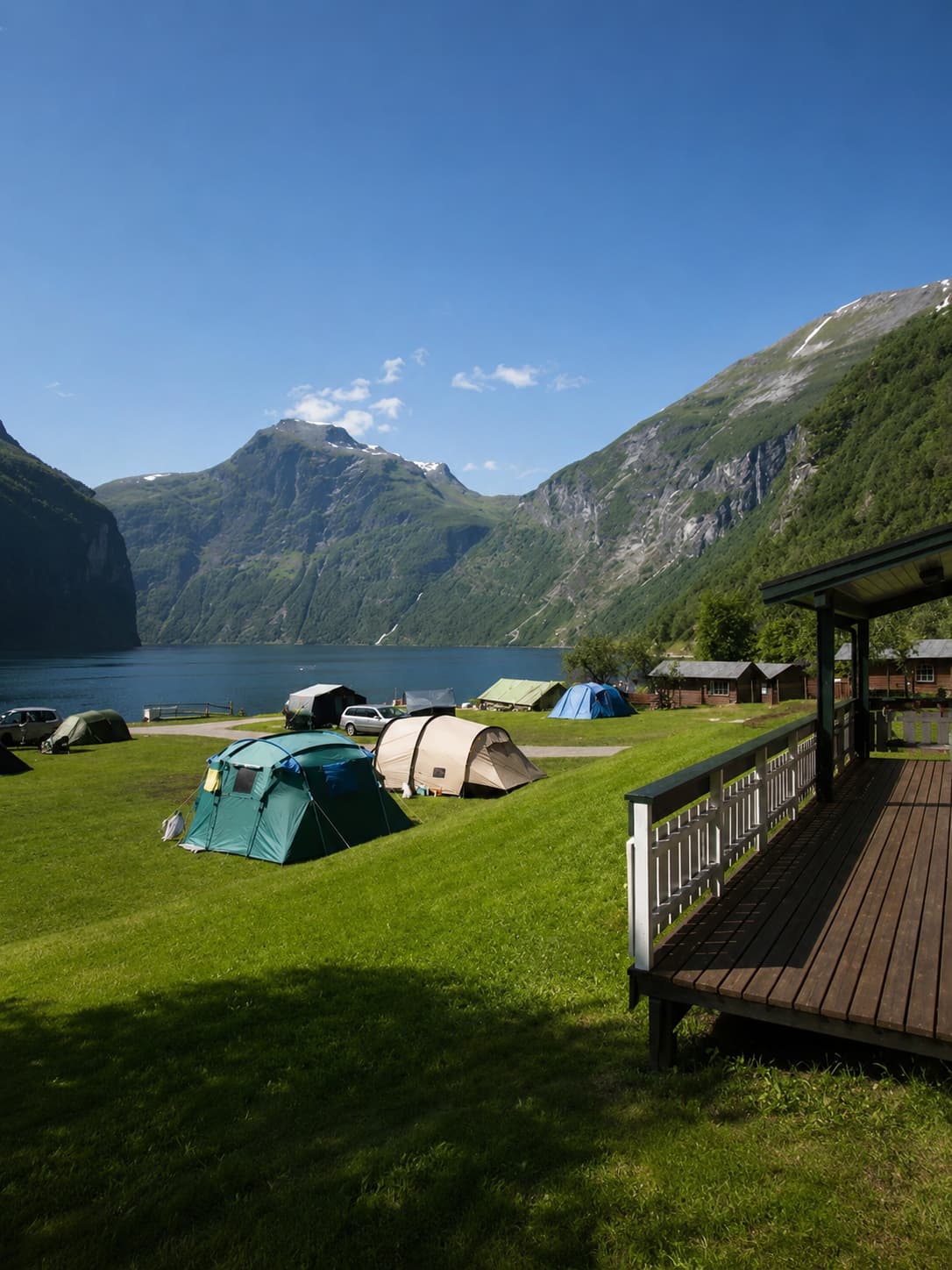
Hotels and guesthouses in the main fjord towns in summer range from NOK 1,500–3,000 per night for a double room, with Bergen and Geiranger at the higher end. Camping officially reduces accommodation costs to NOK 200–400 per night at established sites with facilities. However, Norway’s allemannsretten — the right-to-roam law — takes this further: tents, vans, and campervans may be positioned on uncultivated land anywhere in the country, provided they are at least 150 metres from the nearest dwelling and leave no trace. On a road trip covering scenic countryside, this right eliminates accommodation costs entirely for nights where you’re prepared to sleep in a tent or camper. In other words, it is not a loophole; it is a legal right that meaningfully changes the budget maths for anyone who uses it.
Allemannsretten applies across Norway, but some high-pressure tourist areas have introduced informal no-camping zones around specific viewpoints. The Geiranger area has seen increased local pressure on wild camping near the main viewpoints — pitch at least 150 m from any dwelling as required, and avoid the immediate surroundings of the Ørnevegen viewpoint area where local municipality signs ask for restraint. Verify current local guidance before setting up near Geiranger specifically.
Where costs surprise first-timers on a Norway road trip
The three cost categories that consistently catch people off guard on a Norway road trip are food, ferry crossings, and parking in Bergen. Supermarkets are the right answer for most meals — Norwegian supermarkets (Kiwi, Rema 1000) are moderately priced and carry everything needed for self-catering on a road trip. In contrast, restaurants in fjord villages and at tourist attractions are expensive even by Norwegian standards; a sit-down lunch in Geiranger can cost NOK 250–400 per person. Ferry crossings in the fjords cost NOK 150–250 per car per crossing and accumulate quickly over a multi-day circuit. On top of that, Bergen parking in the city centre runs NOK 200–350 per day.
A realistic 10-day budget range
| Car hire (10 days, compact) | NOK 4,500–8,500 (€380–720) |
| Fuel (1,200 km, petrol) | NOK 1,800–2,500 (€150–210) |
| AutoPASS tolls + admin fees | NOK 1,000–1,500 (€85–125) |
| Ferry crossings (est. 5–8 crossings) | NOK 1,000–2,000 (€85–170) |
| Accommodation (mix of hotel + camping) | NOK 6,000–14,000 (€500–1,200) per person |
| Food (supermarket-led, some restaurants) | NOK 3,500–6,000 (€300–510) per person |
| Total per person (10 days) | €1,400–2,200 excluding flights |
The range is wide because accommodation and food choices have the most leverage. A tent-and-supermarket approach to this circuit brings the total to the lower end. Mid-range hotels every night with restaurant dinners, in contrast, push it to the top of the range and beyond. Most people fall somewhere in between.
06 — Is It Difficult to Drive in Norway?
Norway’s mountain roads are more manageable than their reputation suggests for most drivers, with a few specific caveats that are worth understanding before you arrive at a hairpin 600 metres above a fjord in a vehicle you collected three hours ago.
Road widths, passing places, and campervan warnings
The main roads on this circuit — E16, E39, the primary fjord roads — are well-maintained and perfectly manageable in a standard car. That said, the sections that require attention are the older fjord-side roads and, specifically, Trollstigen and the Eagle Road above Geiranger. Trollstigen has passing places on the narrower sections and a one-way system at its tightest points. In peak summer, coaches use these roads in significant numbers, and the protocol for pulling over to let a coach descend while you’re on a hairpin is something to understand before you experience it for the first time.
Campervans and motorhomes face specific width restrictions on several mountain passes and fjord roads. Some secondary roads on this circuit are signed as unsuitable for vehicles over a certain length or width. Therefore, if you’re renting a campervan, confirm the specific restrictions for each section with the rental company before setting out — the Norwegian Scenic Route signage includes vehicle warnings, but they appear at the road entrance rather than on the booking website.
Speed limits, mountain passes, and GPS caveats
Speed limits on mountain passes and most fjord roads run 50–70 km/h. GPS travel time estimates for Norwegian routes are systematically optimistic — a route that a mapping app predicts will take 2 hours often takes 2.5 to 3 hours once you account for the actual speed limits, the photography stops you didn’t plan for, and the ferry wait that turned out to be 45 minutes rather than 20. Consequently, the easiest adjustment on a Norway road trip is simply to plan fewer driving kilometres per day than you think you need. Four to five hours of actual driving time per day is a reasonable maximum for keeping the trip enjoyable.
Ferry crossings — how they work and what they cost
Ferry crossings are a regular part of Norwegian road travel rather than an unusual event. On this circuit, you’ll cross at least two or three fjords that have no road alternative. Ferries accept vehicles and passengers, run on fixed timetables (check Entur.no or the specific ferry operator’s app), and cost NOK 150–250 per car per crossing including driver. A small number of high-demand summer routes — the Geiranger–Hellesylt crossing across the Geirangerfjord is the most notable on this circuit — book out for vehicle space in July. For those specific crossings, book in advance via fjord1.no. Otherwise, turning up and queuing is standard practice for most other crossings.
07 — How This Norway Road Trip Connects to the Rest of Norway
The Western Norway circuit described here is a self-contained trip. That said, it connects naturally to two other major Norway road trip chapters for anyone with more time or a broader itinerary in mind.
North from Åndalsnes, the E136 connects to the E6 spine that runs the length of Norway. Specifically, the Lofoten Islands are roughly 12–14 hours of driving north from there — or a flight from Ålesund to Bodø, then a ferry across to the archipelago. The Lofoten Islands guide covers that circuit in full. It is a genuinely different experience from the Western fjords — Arctic, flatter on the islands themselves, more remote, and better suited as a second Norway trip than a same-trip extension unless you have three weeks available.
For a completely different kind of North Atlantic trip, the Faroe Islands are reachable by direct ferry from Bergen (Smyril Line) — a logical extension for anyone flying into Bergen and wanting a broader North Atlantic circuit that doesn’t require retracing the same road.
Driving, cars and road safety on a Norway road trip
Tolls, ferries and wild camping on a Norway road trip
08 — Honest Verdict
A Norway road trip is one of the most genuinely impressive things available in European travel, and also one of the most easily ruined by rushing it. In particular, the circuit described here works best for people who can tolerate unpredictable weather without treating every grey morning as a failure, who find the logistics of ferry timetables and mountain pass closures interesting rather than stressful, and who are prepared to spend more money than they spent on their last European holiday without immediately comparing it to a week in Italy on the same budget.
Who this Norway road trip is really for
It’s less suitable for people who need a pre-set itinerary to feel secure — the flexibility required to deal with a Trollstigen closure, a Geiranger ferry queue, or a three-day rain spell is part of the trip rather than a contingency. In that respect, a Norway road trip functions as a test of your relationship with unresolved situations more than most other European drives do.
The Western fjords circuit specifically is the most spectacular per kilometre of any road trip in Europe that I’ve driven. Admittedly, the costs are real, the weather is unpredictable, and July crowds at Geiranger are a genuine issue. None of that changes the fact that standing above Trollstigen in early morning light, with the Stigfossen falls audible before they’re visible, is an experience with very few equivalents on the continent. Go in June. Build buffer days in. Don’t pre-book every night.
The best day on this circuit will probably not be the one you planned for.
It will be the one where the ferry was late, the weather shifted, and you ended up somewhere you hadn’t booked.